

Saturday, 14 July 2012
Halliday v Holliday : American Lawyer Stripped of Heraldic Arms
Following five years of legal wrangling the matriculation of Arms to an American lawyer who also claimed to reside at Corehead Tower has been 'expunged' from the records. A summary of events was published in the Moffat News -13 July 2012.


Saturday, 19 November 2011
Update on Corehead Archaeology Dig
Tomorrow is the third day of the dig to locate Corehead tower. So far we have dug five test pits in the vicinity of the plantation behind the current Corehead farmhouse.
The first weekend was spent walking the land in the wood looking for possible clues and identifying the rectangular earthwork that was visible on a 1951 aerial photograph, prior to the planting of the wood. Two pits were started in the earthwork and after the removal of earth and smaller stones,larger stones were discovered deliberately placed on top of each other.
It is difficult to say at this stage if they are the foundations of a building or an earlier stone dyke.
Last weekend three pits were dug just outside the wood on a green mound which appears to have the shape of a building.
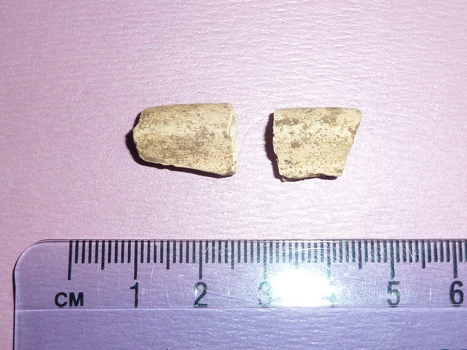
Oral tradition says this was used as a quarry and despite some promising lumps and bumps this does appear to have been used for stone clearance and later as a midden for the farm. Everything from 19th century bottles and plates to toothpaste tubes were uncovered. However there was one piece of pottery that excited Jane our visiting archaeologist.This unglazed rim from a vessel has tentatively been dated as medieval.

The days are short just now and our work stops about 3.00pm but the low sun of winter and days of frost and light snow are useful for detecting ancient human activity in the landscape. Here beside where we are working can clearly be seen the green ridges of medieval 'rig and furrow' cultivation.
This weekend we will return to the wood and extend trenches 1&2 and hopefully find some signs of human habitation.
 |
| View towards the Devil's Beef Tub |
It is difficult to say at this stage if they are the foundations of a building or an earlier stone dyke.
 |
| Pit 1 |
 |
| 'Quarry' site |
Oral tradition says this was used as a quarry and despite some promising lumps and bumps this does appear to have been used for stone clearance and later as a midden for the farm. Everything from 19th century bottles and plates to toothpaste tubes were uncovered. However there was one piece of pottery that excited Jane our visiting archaeologist.This unglazed rim from a vessel has tentatively been dated as medieval.
 |
| Rig and Furrow |
This weekend we will return to the wood and extend trenches 1&2 and hopefully find some signs of human habitation.
 |
| The sun sets and the moon rises over Corehead |
Saturday, 5 November 2011
Archaeology Dig at Corehead

Tomorrow and for the next three successive Sundays in November will see the start of an archaeological excavation to locate the site of Corehead Tower. Many Halliday readers will know that the Dumfriesshire family have long been associated with Corehead. This stems from the legend that Tom Halliday who lived at Corehead was nephew to William Wallace the Scottish guerrilla leader during the Scottish Wars of Independence. The earliest record for this association appears in The Wallace a poem written in Scots by Blind Harry about 1477. Historians and scholars have dismissed much of the poems contents as fiction and yet there are elements within which on closer examination bear some element of truth. This is something I will return to later.

Black and white photos from Clarence Halliday early 1960's book
The poem does not mention a tower or castle only that they stayed at 'the Corhead'.A later Border Ballad called The Sang of the Outlaw Murray also refers to the Halliday family of Corehead. Yet despite searching for many years I have not yet found any charter or reference to a land transaction that connects the family specifically to Corehead.
It is known that the Bruce family were Lords of Annandale from 1124 and later the Douglases were granted the lands of Moffat and Corehead in the 14th century. They held them until the 1550s when Johnstone of Craigieburn purchased them.This branch of the Johnstone clan then took the title Johnstone of Corehead.They had other towers at Cornal,Corehead and Lochhouse. .
The earliest surviving record of a tower at Corehead appears in a map of 1597 which depicts the tower at the head of Annandale.

The Johnstone family continued to live at Corehead farmhouse until the late 19th century.

In 2009 the farm and surrounding hill land around the Devil's Beef Tub was purchased by the Borders Forest Trust.
Tomorrow a small team of volunteers and archaeologists will begin the hunt for the tower. The area will need to be cleared of fallen trees and test pits will be dug at promising sites. All very exciting
Saturday, 16 July 2011
New Web Site Launched

chris@scotlandsgenealogy.com
http://scotlandsgenealogy.blogspot.com/
Twitter: @scotsgen
Thanks
Saturday, 28 May 2011
Halliday Hill

The hill has a commanding panoramic view over Annandale to the Solway Firth and the Border. In the R.C.Reid collection a John Carruthers,Laird of Mousewald obtained a charter from John Halliday of Hoddom on 31 May 1439.This John Carruthers was later Captain of Lochmaben Castle in 1446.Reid was inclined to believe that possibly the name Hallidayhill until recently part of Hoddom estate,is derived from this family- the Hallidays of Hoddom.George Black in his 'Surnames of Scotland' held the same view.
Saturday, 7 May 2011
Arms of Robert Douglas Halliday of Coldbrook,Island of St Croix
 Arms of Robert Douglas Halliday Esquire of Coldbrook in the Island of St Croix: Argent a Sword erected in Pale proper hilted and pommelled Or the last within a crescent in base Gules in a dexter Canton Azure a Saltyr of the Field.
 Motto: Virtute Parta
28 March 1775
Tuesday, 3 May 2011
Early Map of Corehead :1590

Corehead Tower which was probably built about 1570 was owned by the family of Johnstone of Corehead.The tower was probably on the site of earlier fortifications and perhaps the location for William Wallace meeting his nephew Tom Halliday. The tower on the map is the very top one on the left handside.It is possible to zoom in on the British Library site. http://bit.ly/jV6ntM
Subscribe to:
Posts (Atom)

